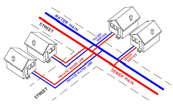
During excavations and drilling a lot of undocumented services such as pipes and cables gets damaged and such damages are costly and are detrimental to the success of a project. For the success of such projects the accurate positioning and location of such underground services is paramount.
Underground Utilities and services are detected and positioned using latest technology of a Ground penetrating Radar (GPR). GPR uses a transmitting antenna that emits pulses of high frequency electromagnetic waves into the subsurface. The penetrating electromagnetic waves are transmitted downward and reflected by changes in the dielectric properties of the underground features to a receiver. GPR data can be collected continuously or at fixed station intervals.
We use this non-intrusive testing method to locate underground utility lines for a broad range of engineering, environmental, and construction purposes

What we offer?
- Detect and delineate buried waste materials (bulk and drummed).
- Locate buried utilities (metallic and non-metallic).
- Locate buried pipes and cables.
- Evaluate roadway and airport pavement thickness.
- Locate buried structural components.
- Locate and mark out subsurface voids in or below concrete.
- Locate Underground Storage Tanks (UST) and drums.
- Conduct environmental test bore clearings.
- Map grave sites and cemeteries.
- Perform forensic investigations.
- Identify trench line clearances.
- Bedrock profiling & mapping services.
